 |
Maps showing property of John Forbes Lawrie in Blackley and Harpurhey |
|
Link to John Forbes Lawrie at Glen Villa |
 |
|
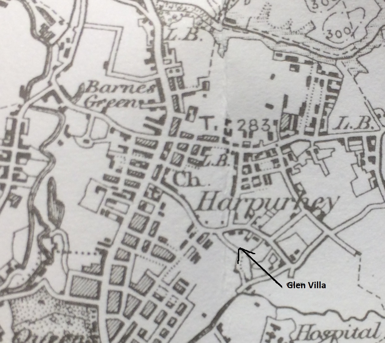
In this section of the 1896 OS map of Manchester, Rochdale Road heads in a roughly northerly direction. Moston Lane is east-west and Church Lane winds in a South-easterly direction. Glen Villa and its land is marked by an arrow. At this time Vauxhall Street (later Dalbeattie Street) had not been built. Building development was beginning along Rochdale Road and in Harpurhey. ---------------------------------------------------------------------------------------------------------------------------------------------------------------------------------------------------------------------------------- The Manchester electric tramway system began operations on 6 June 1901, replacing the horse-drawn system which had operated since the Manchester tramways act of 1870. By the end of 1901, further sections had been opened between Cheetham Hill Road and Rochdale Road; High Street and Blackley; High Street and Moston Lane. By 1903 the whole of the then 140 mile network and been rebuilt and re-equipped, so that on 13 April that year, horses pulled their last trams within Manchester. |
 |
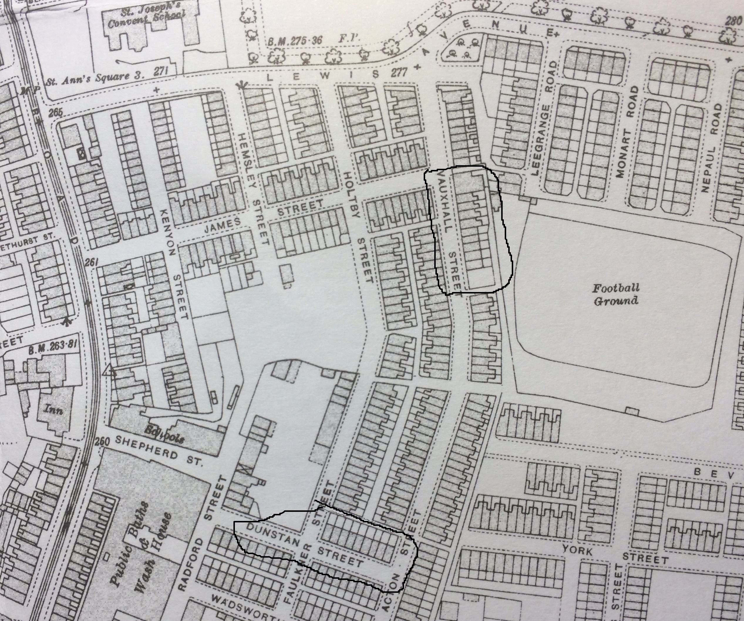
As a result of the improved transport links, the semi-rural area of Blackley apparent in the 1896 map had been largely urbanised by 1915. Grandfather would acquire two blocks of property here: Nos 32-50 Dalbeattie Street (Vauxhall Street on the 1915 map) purchased in 1947. They lay on the east (righthand) side, from the larger workshop (no 50) to the vacant block, circled on the plan. Nos 2-18 Dunstan Street, that is the block on the North side between Faulkner Street and Acton Street, purchased in 1953. ---------------------------------------------------------------------------------------------------------------------------------------------------------------------------------------------------------------------------------- |
 |
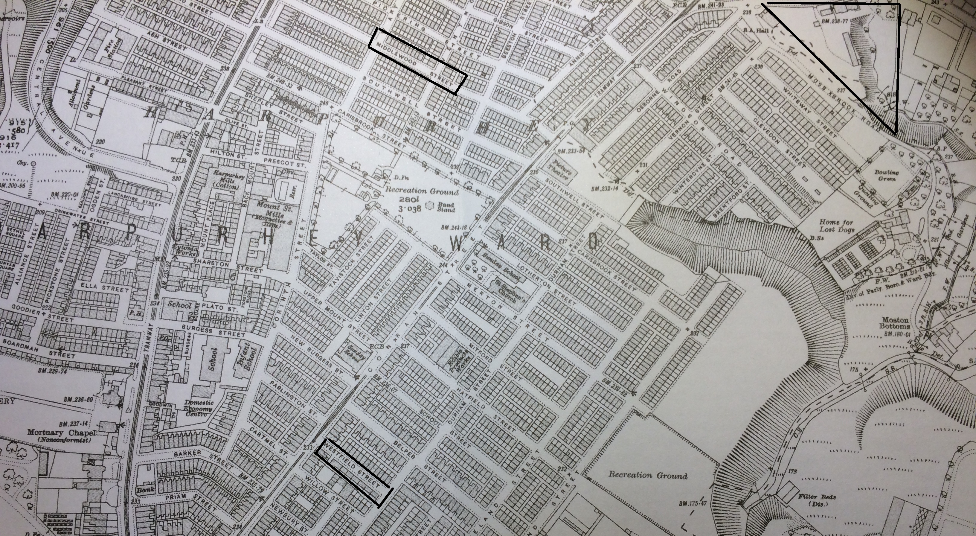
In the above plan of Harpurhey from the Alan Godfrey 1931 plan 104-03, The Glen Villa lands are marked by a rough triangle in the NE corner. JF Lawrie's properties were Nos 4-14 Westfield Street (the south side), purchased in 1951 and circled in bottom left of plan; 73-79 Middlewood Street, circled, but for which I don't have the purchase deeds. Also lacking the deeds: 18-22 and 57-59 Church Lane, to the west of Glen Villa, which also lay on Church Lane and just off the Northern edge of this map. |